
The meteorology department has issued a yellow weather warning for Monday, signaling potentially hazardous conditions with intense storms and heavy rainfall. Residents are advised to secure outdoor furniture, clear gutters, and prepare an emergency kit with essentials like water, food, flashlights, and a first aid kit to stay safe during the upcoming weather event.
What should you do during a yellow weather warning?
- Secure outdoor furniture and clear gutters.
- Stay updated with local news for weather changes.
- Prepare an emergency kit with water, food, flashlights, and a first aid kit.
- Exercise caution if boating and consider staying ashore.
A Closer Look at Weather Alerts
The meteorology department has sounded the alarm for citizens, alerting them to a yellow weather warning scheduled for Monday. This crucial advisory is set in motion from 10am until 7pm, signaling potentially hazardous conditions. During this time, intense storms are anticipated, accompanied by precipitation rates ranging from 35 to 55 millimeters per hour. Such a significant amount of rain in a short period can lead to flooding, especially in areas with poor drainage or already saturated ground.
Residents are advised to prepare for the storm’s impact. This includes securing outdoor furniture, clearing gutters, and staying updated through local news sources for any changes in the weather conditions. Authorities often recommend having an emergency kit ready, with essentials such as water, non-perishable food, flashlights, and a first aid kit.
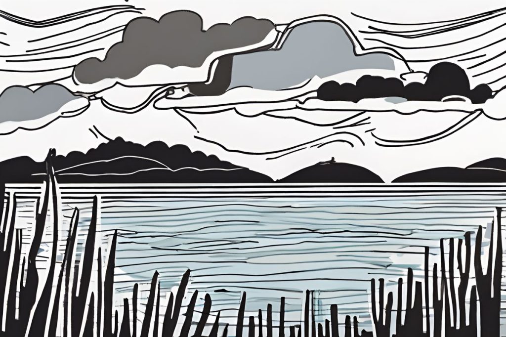
Anticipated Weather Patterns
The day is expected to commence with a deceptive calm, featuring partly cloudy skies and isolated showers, predominantly in the mountainous regions. However, this tranquility will evolve into a full overcast sky, with the incoming storms spreading across the island. Adding to the complexity of the situation, there is also the possibility of hail – a phenomenon capable of causing damage to crops, vehicles, and infrastructure.
The temperature will peak at 24C inland, providing a false sense of security with its moderate warmth. Coastal areas will experience slightly cooler weather at 22C, while the higher mountain regions will only reach 12C. Winds will play a crucial role in the day’s unfolding, initially mild and originating from the north to south-easterly direction, intensifying in the afternoon with strengths reaching up to 5 Beaufort. Rough seas are expected, and small craft advisories may be in place, urging boaters to exercise caution or avoid going out entirely.
Weather Conditions Into the Night
As daylight fades, the overcast conditions will persist, bringing with it a continuity of intermittent rains and the potential for isolated storms, particularly in the western, southern, and eastern parts of the region. Temperatures will experience a significant drop post-sunset, with inland areas cooling down to 10C, coastal regions mildly warmer at 13C, and a chilly 5C in the elevated mountain locales.
Though the winds are expected to maintain their north- to south-easterly course, they will likely oscillate between moderate to strong throughout the night. The persistent rough seas will continue to challenge marine activities, making maritime travel and fishing ventures inadvisable.
Looking Ahead
In the subsequent days, namely Tuesday through Thursday, the unsettled weather is likely to continue its presence. Clouds and isolated storms will remain a constant, with no significant improvement in conditions. Temperature-wise, Tuesday will mirror Monday’s readings, aligning closely with climatic averages for the season. However, a subtle warming trend is projected for Wednesday and Thursday, providing a glimmer of respite from the otherwise relentless spell of adverse weather.
Residents should remain vigilant and follow guidance from weather officials and local authorities. It’s essential to be mindful of such weather warnings, as they are put in place to protect individuals and communities from the unpredictable forces of nature.
What should you do during a yellow weather warning?
During a yellow weather warning, it is important to secure outdoor furniture, clear gutters, and prepare an emergency kit with essentials like water, food, flashlights, and a first aid kit. Stay updated with local news for any weather changes and exercise caution if engaging in activities like boating.
What are the anticipated weather patterns for the upcoming storm?
The upcoming storm is expected to start with a calm morning featuring partly cloudy skies and isolated showers, mainly in mountainous regions. However, the day will progress to an overcast sky with intense storms spreading across the island. Hail is also a possibility, which can cause damage to crops, vehicles, and infrastructure.
What are the weather conditions expected into the night?
As night falls, overcast conditions and intermittent rains will persist, with the potential for isolated storms in the western, southern, and eastern parts of the region. Temperatures will drop significantly after sunset, with inland areas cooling down to 10C, coastal regions at 13C, and mountain locales at 5C. Winds will remain north- to south-easterly, oscillating between moderate to strong, with rough seas persisting.
What can we expect in the days following the yellow weather warning?
The unsettled weather is likely to continue from Tuesday through Thursday, with clouds and isolated storms remaining a constant presence. Temperatures will remain similar to Monday on Tuesday, but a slight warming trend is projected for Wednesday and Thursday. Residents should stay vigilant and follow guidance from weather officials and local authorities to stay safe.